Outdoor Recreation
Asset Map
Colorado’s Outdoor Recreation Economy – Understanding Colorado’s Assets
Asset maps are a common tool in community development work contributing to the discovery of how assets relate to one another within a region. This mapping effort considers the entire outdoor recreation economy in Colorado with a focus on collecting information about assets including businesses, nonprofits, governments, and educational providers.
The initial framework of this map includes secondary information and outdoor recreation business information provided by the Colorado Office of Outdoor Recreation. CSU’s Geospatial Centroid cleaned and geolocated address information of these entities to make them “mappable,” usable, and accessible in ArcGIS Online. These efforts provide the basis for the Outdoor Recreation Asset map application.
The next step is to gather input directly from the outdoor recreation community. Users may provide information directly into this map (instructions below). CSU also will be conducting informal focus groups to gather additional outdoor recreation community input.
The desired result is a community-informed asset map that provides Colorado’s outdoor recreation industry with:
- An increased awareness of outdoor recreation businesses across the state.
- Information for industry networking and collaboration.
- Potential opportunities for mutually beneficial advancements within the industry.
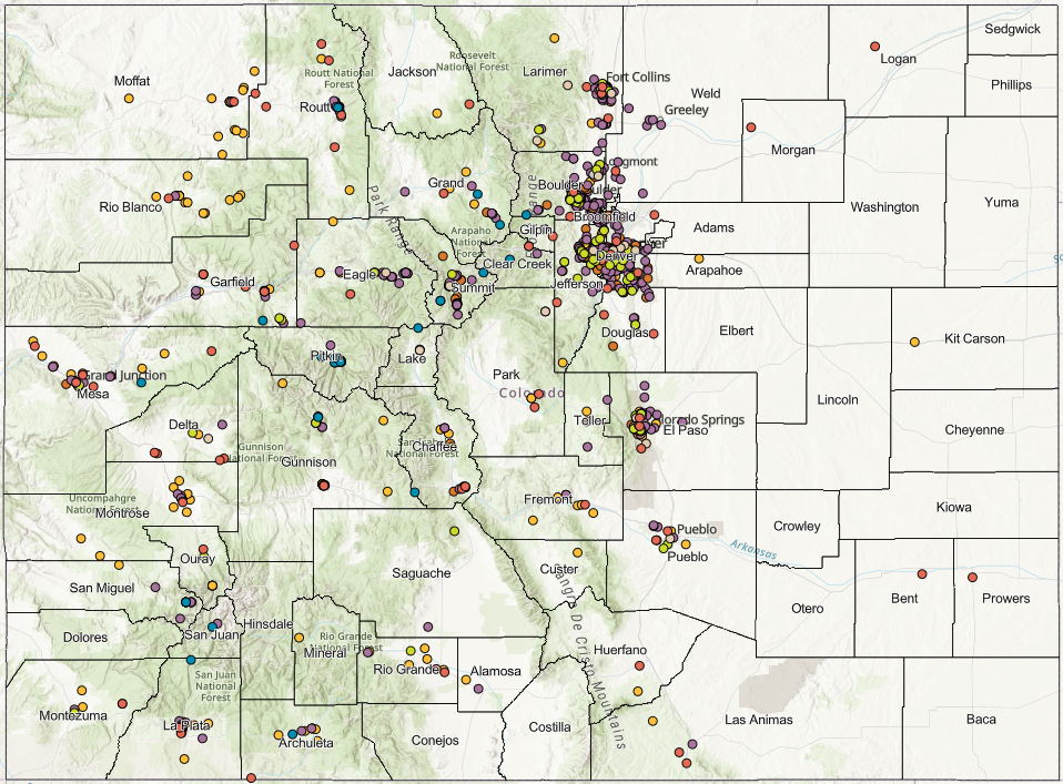
The map provides location and contact information for Colorado’s outdoor recreation assets. It does not include information about infrastructure or cultural assets. Outdoor recreation infrastructure and natural amenity assets can be viewed in Colorado Parks and Wildlife’s Digital Toolkit.
Providing Input
Identify businesses in this industry. If your business manufacturers bike frames, produces young outdoor stewards, or provides reliable gear for adventuring in Colorado, your information is needed to build a comprehensive, community-informed map.
Adding your business takes about ten minutes. Location and contact information will be shared with anyone who views the map.
Additions to the map will be made through regular updates through December 31, 2025.
Questions about this map or entering your information? Contact the project lead Guinevere Nelson. Your participation is greatly appreciated.
About the work
CSU’s Office of Engagement and Extension and College of Human and Health Sciences is elevating its role in Colorado’s robust outdoor recreation economy. With funding from Colorado’s Office of Outdoor Recreation, and in partnership with CSU’s Geospatial Centroid, CSU is expanding extension services to outdoor recreation audiences through the creation of this digital asset map.
Project lead: Guinevere Nelson